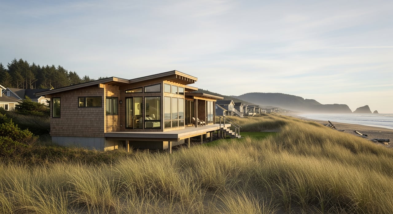
You can fall in love with a Rockaway Beach lot in a single walk, but permits and setbacks are what make it truly buildable. If you are eyeing a home site or small development, the coastal rules, hazards, and utility details matter as much as the view. In this guide, you’ll learn how Rockaway Beach regulates building, what can change your setbacks, how to check hazards and utilities, and what to verify before you write an offer. Let’s dive in.
Permits in Rockaway Beach: who does what
Rockaway Beach projects often involve city, county, and state layers. The city handles zoning and land‑use review, and may coordinate building permits directly or through county or regional services. Statewide building codes apply through the Oregon Building Codes Division.
- Start with the city’s Planning and Building pages to confirm processes and contacts at the City of Rockaway Beach.
- If any functions are administered by the county, coordinate with Tillamook County.
- Coastal policy consistency is implemented locally under the Oregon Coastal Program led by DLCD.
- Building plans and inspections follow statewide code through the Oregon Building Codes Division.
Typical sequence:
- Pre‑application consultation with city planning.
- Confirm zoning, allowed uses, and any overlay zones.
- Land‑use/site‑plan review and any design or conditional approvals.
- Submit required technical reports (geotech, stormwater, septic or sewer confirmation).
- Coastal consistency review if applicable.
- Building permit application with engineered plans.
- Utility permits and connection approvals.
- Inspections and final approvals.
Setbacks on coastal lots
Setbacks in Rockaway Beach come from the property’s zoning and any overlays for shoreland, floodplain, dunes, or bluffs. They include front, rear, side, and sometimes shoreline or bluff setbacks. Distances vary by zone and site conditions, so you should not rely on generalized numbers.
How to confirm your setbacks:
- Identify the parcel’s zoning and read the setback table in the city code on the City of Rockaway Beach site.
- Check for overlays that affect siting, including shoreland, floodplain, or tsunami considerations.
- Order a current boundary survey that shows easements and rights‑of‑way that can shrink the buildable area.
- Book a pre‑application meeting to review your concept with planning staff before you commit to a design.
Coastal hazards: bluffs, dunes, flood, tsunami
Coastal bluff or dune proximity can change where you can safely build. Many bluff or dune sites require a geotechnical report to establish a safe building line and foundation approach. Vegetation removal near dunes or bluffs is often regulated.
Floodplain and tsunami considerations:
- Much of the coast lies in FEMA Special Flood Hazard Areas. Use the FEMA Flood Map Service Center to check your panel. Building in these areas commonly requires an Elevation Certificate.
- Review tsunami and landslide susceptibility maps from DOGAMI to understand evacuation and siting context. These maps inform risk awareness and may influence design and placement.
Wetlands and sensitive areas
If wetlands, dune wetlands, or streams are present, additional reviews can apply. Some work in wetlands or tidally influenced areas may need permits from the U.S. Army Corps of Engineers and the Oregon Department of State Lands. A qualified wetland consultant may need to perform a delineation before design moves forward.
Use the National Wetlands Inventory as an early screen, then verify in the field:
- Check the USFWS National Wetlands Inventory for mapped features.
- If wetlands are suspected, plan time for delineation and potential state or federal permitting.
Utilities and infrastructure: what to verify
Water and sewer
- Confirm if the lot is within the city’s water and sewer service area and if laterals exist with City of Rockaway Beach Public Works.
- If city sewer is unavailable, you will need septic review through Tillamook County Environmental Health. Start with Tillamook County for process and contacts.
Power, gas, and communications
- Identify the electric service provider and confirm capacity and service points. Providers vary on the coast.
- Natural gas may not be available everywhere. Many homes use electric systems or propane.
- Check broadband and telephone availability during due diligence if connectivity is important to your plans.
Stormwater and drainage
- Expect to manage stormwater on site and avoid directing runoff onto neighboring properties or dunes. Larger footprints or more impervious area usually trigger a stormwater plan.
Easements and rights‑of‑way
- Recorded easements, access strips, and public rights‑of‑way can reduce your buildable envelope. Obtain the recorded plat, easement exhibits, and a current survey.
Pre‑offer due‑diligence checklist
Documents to collect before you write an offer
- Title report and recorded deed to identify easements and restrictions.
- Current boundary or ALTA survey showing improvements, easements, and topography.
- Zoning designation with code text for setbacks, height, and lot coverage.
- City or county zoning and overlay maps and a GIS parcel report.
- FEMA flood panel and DOGAMI tsunami or landslide susceptibility maps.
- Utility maps, service availability letter for water/sewer, and any system development charges.
- Prior geotechnical reports, soils tests, or perc test results.
- HOA CC&Rs if applicable.
- Recent site photos, aerials, and any past permit records.
On‑site reconnaissance
- Walk the site to observe slope, dune or bluff conditions, and drainage patterns.
- Look for signs of erosion or slope movement.
- Identify vegetation constraints and feasible access routes for construction.
Targeted studies during your contingency period
- Preliminary geotechnical evaluation to flag foundation approach and potential bluff or dune setbacks.
- Perc tests and septic design if sewer is not available.
- Wetland delineation if mapping or site conditions suggest wetlands.
- Utility capacity and connection cost confirmations from providers.
- Detailed title review for easements and restrictions.
Key questions for the city
- What are the exact setbacks, height limits, and lot coverage for this zoning?
- Which overlays apply and what special restrictions follow?
- Any prior approvals or variances on this or adjacent lots?
- Any open code enforcement issues?
- Typical timelines for land‑use and building permit reviews, and expected fees or SDCs?
Timelines and budget ranges
Every project differs, but you can plan around typical windows:
Approximate timelines
- Pre‑application and basic research: 1 to 4 weeks.
- Preliminary geotechnical desk review and limited borings: 2 to 6 weeks.
- Perc tests and septic evaluation: 1 to 4 weeks for scheduling and analysis.
- Administrative site‑plan review: 4 to 12 weeks.
- Conditional use or variance with hearings: 2 to 4 or more months.
- Building permit review: 2 to 12 or more weeks depending on complexity.
- Utility connection permits: 2 to 8 or more weeks.
Typical cost categories to budget
- Survey: about $1,500 to $10,000 or more based on size and complexity.
- Geotechnical report: about $2,000 to $20,000 or more for coastal sites.
- Perc tests and septic design: about $500 to $5,000 or more depending on scope.
- Permit fees: city applications, building permits, plan reviews, and SDCs vary.
- Utility connection fees and any required main extensions.
- Design and engineering for structural, civil, and stormwater.
Smart next steps
- Schedule a pre‑application meeting with planning at the City of Rockaway Beach.
- Pull zoning and overlay information, then order a current boundary survey.
- Request a water and sewer availability letter and locate laterals.
- If anywhere near dunes or bluffs, commission an expedited geotechnical desk review before you finalize design.
- Map flood and tsunami hazards using FEMA and DOGAMI, and screen for wetlands with the National Wetlands Inventory.
If you want a second set of eyes before you make an offer, we can help you triage feasibility, line up the right consultants, and keep your due diligence on track. For discreet guidance on premium coastal lots and buildable parcels, reach out to Home + Sea Realty.
FAQs
What permits are required to build a home in Rockaway Beach?
- Most projects need city land‑use review, coastal consistency review if applicable, and a building permit under statewide code, with utility connection approvals coordinated through city or county offices.
How are building setbacks determined on coastal lots?
- Setbacks are set by zoning and any overlays, and may be modified by geotechnical recommendations near bluffs or dunes, so you must confirm the exact standards with the city and your surveyor.
How do I check if my lot is in a flood zone or tsunami area?
- Use the FEMA Flood Map Service Center for flood panels and DOGAMI for tsunami and landslide susceptibility maps, then verify with city staff.
Do I need a geotechnical report for a bluff or dune lot?
- Often yes; bluff or dune proximity commonly triggers a geotechnical report to establish safe building areas and foundation design.
What if city sewer is not available to my parcel?
- You will need perc tests and septic design through Tillamook County Environmental Health, and a county onsite sewage system permit before building permits can be issued.
How long does permitting usually take in Rockaway Beach?
- Depending on scope, allow several weeks for land‑use review, a few weeks to months for building permit review, and additional time for technical studies and utility approvals.